iGIS for iPad 8.4.11
Continue to app
Free Version
Publisher Description
iGIS - The world's first and leading iOS GIS.
True GIS functionality is now available on the iPad! Your iPad. Your data. Your maps.
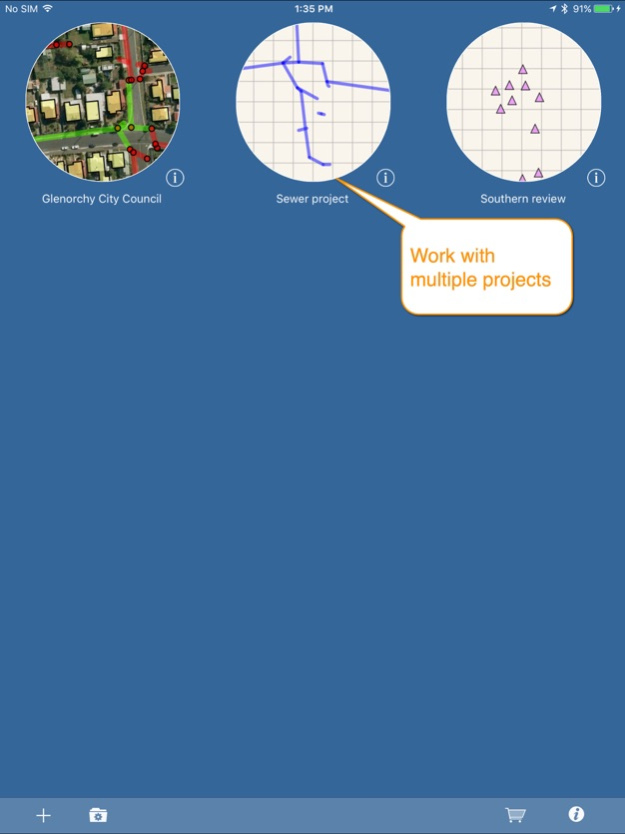
iGIS represents a new era in mobile GIS solutions by enabling users to load, view, investigate, create and export their own data over a background of map service imagery.
Importing data is easy with our unique data import facility supporting Mac, PC and Linux or via the USB cable. ESRI Shapefiles (.shp) are supported at the moment.
Great for field work as your spatial data is stored on the iPad, so there is no need for an Internet connection to see your data. We also support over 3000 projections, so there is no need for data re-projection.
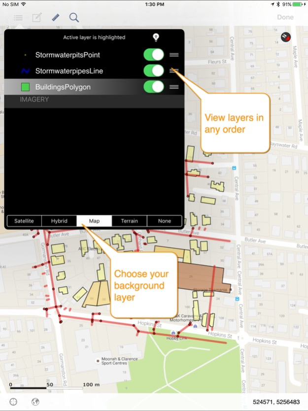
We include support for multiple layers of points, lines, and polygons and imagery – all styled as you like.
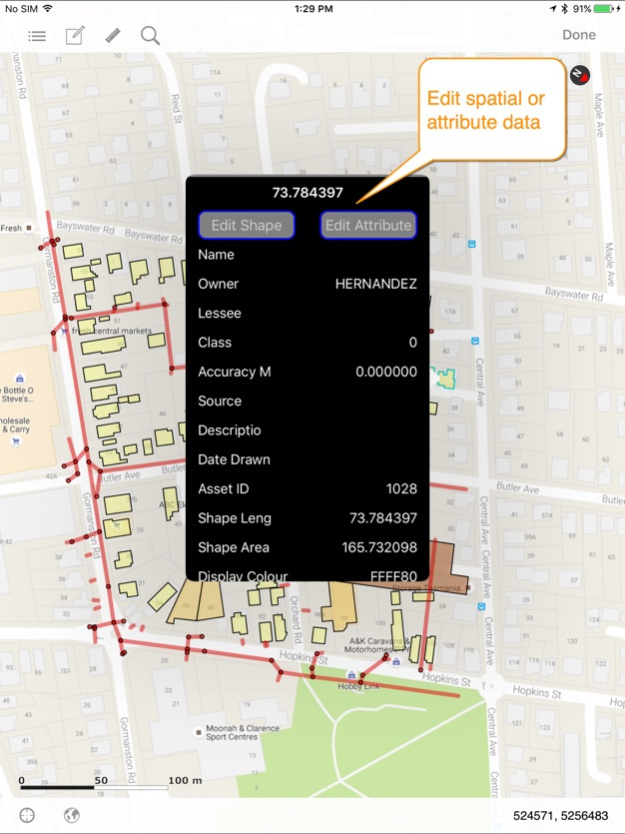
Add comments to your maps - A point layer is added with a name and description field. You can add or edit any of your layers - and even define your own data entry forms with dropdown lists for codes, etc.
Export your layers to ESRI shapefiles for use back in your enterprise.
Other features include:
- Great speed, using our multi-threaded map renderer.
- Support for large datasets.
- Add your own imagery
- Import and export of ESRI Shapefiles.
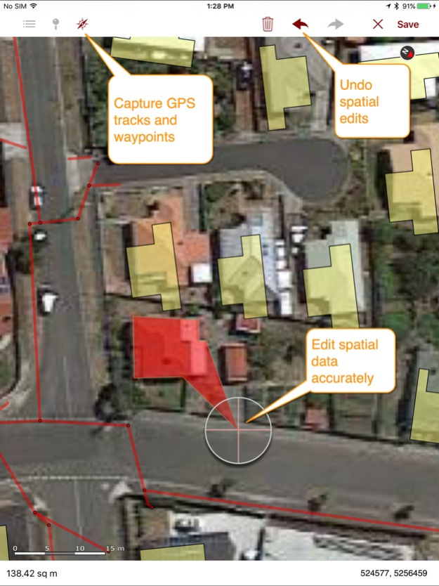
- Display current GPS location in your chosen projection ( + compass)
- Zoom to current location
- Zoom to data extent
- Map Pan, zoom in, zoom out
- Changeable drawing styles for a layer: size, color, transparency
- Set the draw order and visibility of map layers
- Set the zoom scale for layers via a simple slider
- Select and interrogate feature attributes via point and click
This application is designed for GIS professionals and an understanding of some basic GIS concepts such as layers, shapefiles, projections etc, would make using iGIS simpler. Please let us know if concepts in iGIS are unclear.
We know there’s a lot more functionality that we haven’t included. Let us know what features you’d like to see added or improved.
iGIS can use the GPS in the background. Continued use of GPS running in the background can dramatically decrease battery life.
Thanks for your interest,
The Geometry Team
Feb 23, 2021
Version 8.4.11
Added support for GDA 2020
About iGIS for iPad
iGIS for iPad is a free app for iOS published in the Recreation list of apps, part of Home & Hobby.
The company that develops iGIS for iPad is Geometry. The latest version released by its developer is 8.4.11.
To install iGIS for iPad on your iOS device, just click the green Continue To App button above to start the installation process. The app is listed on our website since 2021-02-23 and was downloaded 1 times. We have already checked if the download link is safe, however for your own protection we recommend that you scan the downloaded app with your antivirus. Your antivirus may detect the iGIS for iPad as malware if the download link is broken.
How to install iGIS for iPad on your iOS device:
- Click on the Continue To App button on our website. This will redirect you to the App Store.
- Once the iGIS for iPad is shown in the iTunes listing of your iOS device, you can start its download and installation. Tap on the GET button to the right of the app to start downloading it.
- If you are not logged-in the iOS appstore app, you'll be prompted for your your Apple ID and/or password.
- After iGIS for iPad is downloaded, you'll see an INSTALL button to the right. Tap on it to start the actual installation of the iOS app.
- Once installation is finished you can tap on the OPEN button to start it. Its icon will also be added to your device home screen.
